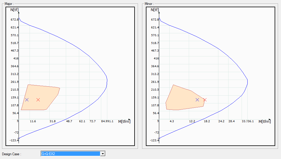
With the new column capacity control screen, it is possible to see the region where the column works for all design situations and to compare it with the capacity curve
Terrain modeling within the Architectural and Static program -Creating 3D terrain from contours and free elevation points -Defining flats, areas and pits on the land -Questioning the elevation at any point of the land -Multi-stage excavation quantity calculation including fill calculation
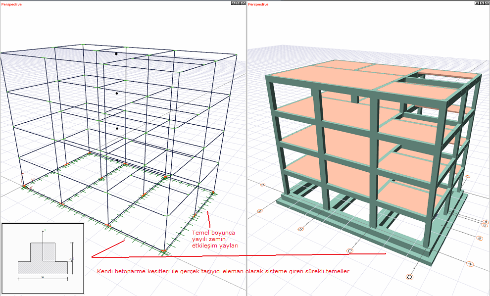
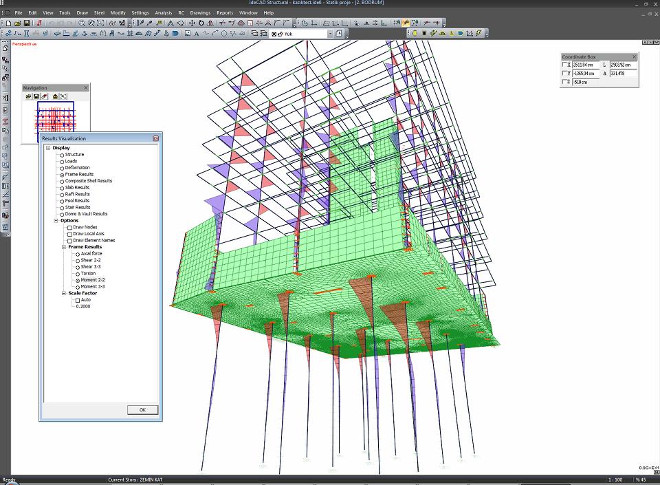
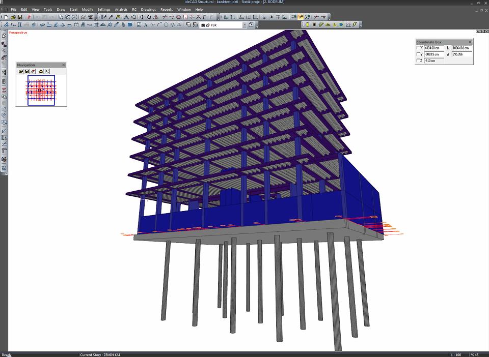 Solving the whole system as a whole by considering the pile elements
 Example deformation (0.9G+EX1 upload)
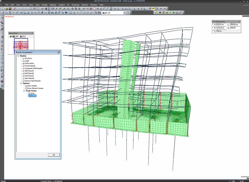 Panels and raft base shell results
 Pile element results (example M2 moment diagram)
![img]](http://www.idecadsupport.com/diger/sove/sove2.jpg[/ img])